Digital Solutions
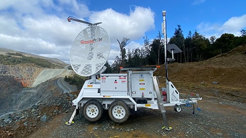
GroundProbe SSR-XT
Tactical and targeted Slope Stability Radar (SSR)
Designed and built for safety-critical monitoring.
Designed and built for safety-critical monitoring.
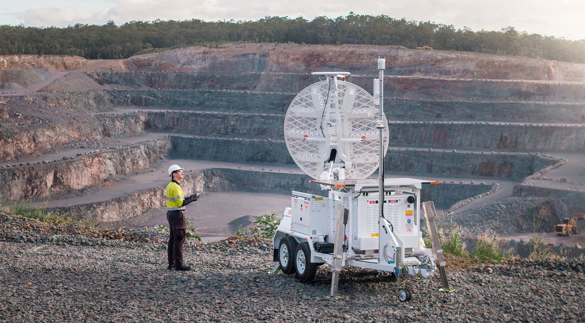
The SSR‑XT, integrated with MonitorIQ® Next, is a safety-critical, targeted solution designed to manage slope instability where movement presents a potential or immediate threat. Using highly precise 3D Real Aperture Radar (RAR) technology, the system delivers real‑time, high‑confidence measurements to support safety‑critical monitoring with minimal operator input.
Built on the industry’s most trusted technology, the SSR‑XT enables early detection of rapid deformation and accelerating movement across mine slopes, tailings dams and adjacent infrastructure. High‑performance hardware and intuitive, user‑centric software workflows support faster deployment, quicker data interpretation, and confident decision‑making in time‑critical situations, helping protect people, assets and operations as conditions change.
Product features
Product features
High-precision slope monitoring for early risk detection
The SSR-XT employs high-precision 3D Real Aperture Radar (RAR) with unique, independent pixels to accurately represent slope surfaces. This architecture delivers consistently high data quality without relying on broad-beam illumination or favourable geometry, even in complex environments.
A targeted pencil beam scans in a precise raster pattern, fully covering defined high-risk areas while maintaining high spatial resolution. This physical targeting approach minimises interference and delivers clean deformation data for safety-critical monitoring.
Targeted monitoring of high-risk zones
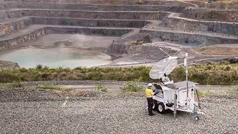
For known high‑risk areas, a targeted monitoring strategy is essential. The SSR‑XT generates a small, focused spot that rotates left‑to‑right and up‑and‑down to fully cover defined risk zones. Each measurement corresponds directly to a physical location on the slope, maximising confidence in movement detection.
Interferometric radar processing ensures sub‑millimetre deformation measurement accuracy is maintained across the full operational range. Measurement precision does not degrade with distance, enabling early identification of subtle precursor movement before failure.

Live 3D model generation for early risk detection
Because the SSR-XT does not rely on a wide beam to illuminate the wall, scan positioning is independent of slope geometry. The pencil beam can be directed to image any area of interest, enabling confident monitoring of complex or irregular slopes without loss of data quality.
Building on this geometry-independent targeting, the radar automatically generates a high-density 3D model of the slope surface using radar data alone. Updated live, scan by scan, the model provides an always-up-to-date representation without relying on external CAD or survey datasets, enabling a deeper understanding of geological shape, structural features, and potential failure locations.
Case studies
GroundProbe® SSR XT / Slope Stability Radars / Digital Solutions
GroundProbe® SSR XT / Slope Stability Radars / Digital Solutions
Related products

Digital Solutions
GroundProbe SSR-FX Slope Stability Radar

Digital Solutions
GroundProbe SSR-SARx Slope Stability Radar

Digital Solutions
GroundProbe SSR-Omni

Digital Solutions
Geotechnical Specialist Services
GroundProbe range
Digital Solutions
Geotechnical Specialist Services

Digital Solutions
Slope Stability Radars

Digital Solutions
BlastVision

Digital Solutions
24/7 Support Desk

Digital Solutions
MonitorIQ® Next

Digital Solutions
Reactive Radars
Explore more
We are a global leader in geotechnical, geospatial and structural monitoring. We deliver a complete portfolio, from sensors to services, for mining and civil infrastructure customers. Our expertise is grounded in Orica's innovation and technical excellence that span more than 150 years.
Contact an expert
Contact an expert
Whether you need support or simply want to learn more, reach out to our Geosolutions team. We’re here to help.
GroundProbe
24/7 Support Desk
Phone: +61 7 3010 8900