

Blog
Single-look vs dual-look InSAR: Understanding the value of multiple viewing perspectives
31 Aug 2026
Interferometric Synthetic Aperture Radar (InSAR) is a powerful monitoring technology capable of measuring millimetre-scale ground and infrastructure movement across large areas. While InSAR provides extensive spatial coverage, the measurements it produces are influenced by the viewing geometry of the satellite acquiring the data.
As a line-of-sight (LOS) measurement technique, InSAR records movement towards or away from the satellite. The viewing perspective therefore plays an important role in determining both the coverage that can be achieved and how displacement is represented within the results.
Understanding the difference between single-look and dual-look InSAR can help monitoring teams maximise coverage, improve interpretation of movement patterns and gain greater value from their monitoring programs.
InSAR measures movement from a specific perspective
Most satellite imagery used for InSAR monitoring is acquired from either an east-looking or west-looking geometry. These observations are typically collected from viewing angles between approximately 15 and 50 degrees from vertical.
Most SAR satellites operate in near-polar orbits and collect imagery by directing the radar beam to one side of the satellite's ground track. As the satellite travels northbound it may observe a site from one side, while a southbound pass can provide imagery from the opposite side, resulting in east-looking and west-looking perspectives.
Commercial SAR missions such as TerraSAR-X (TSX) and COSMO-SkyMed (CSK) can often be tasked to acquire specific viewing geometries, while public missions such as Sentinel-1 and NISAR acquire imagery using predefined observation modes. Depending on the satellite mission and geographic location, one or more viewing geometries may be available for a site.
In some parts of the world, for some satellite missions, however, only a single east-looking or west-looking geometry may be available.
Each viewing geometry provides an independent measurement of displacement along the satellite's line of sight.
The limitations of a single look
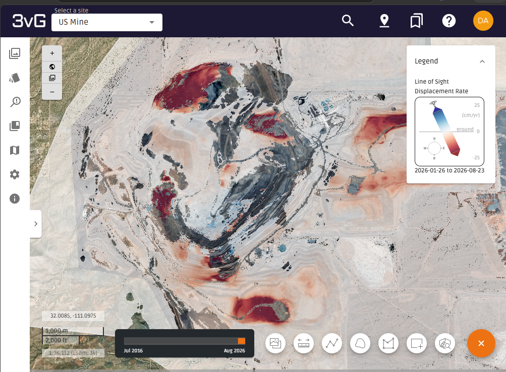
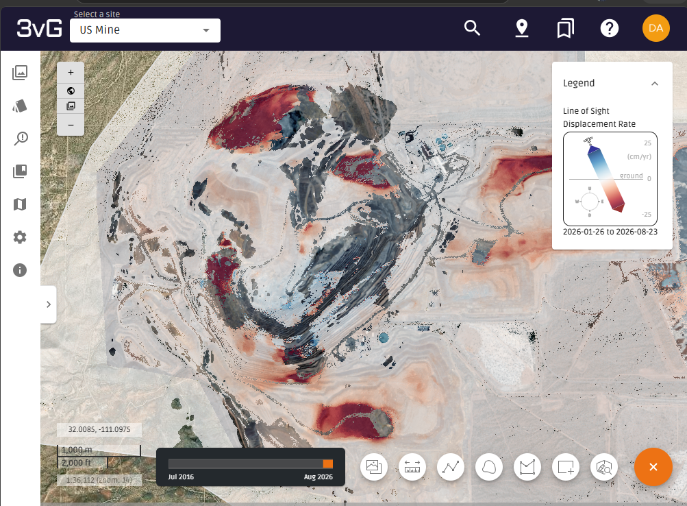
Single-look InSAR provides displacement measurements from one viewing direction. This approach can deliver valuable insight into ground behaviour and is often sufficient for identifying areas of movement and monitoring deformation trends over time.
However, terrain geometry can affect what the satellite is able to observe.
In open pit mining environments, slopes, benches and complex topography can create areas impacted by shadowing, foreshortening or layover. In these locations, reliable measurements may not be available from a particular viewing perspective.
As a result, a single-look dataset may leave gaps in monitoring coverage across parts of a site.
Single-look InSAR also reports displacement along the satellite's line of sight. While these measurements accurately indicate movement relative to the sensor, they do not independently distinguish between vertical and horizontal motion.
How dual-look InSAR improves monitoring coverage
To increase coverage, 3vGeomatics (3vG), a key part of Orica Digital Solutions’ Geosolutions portfolio, frequently acquires and processes imagery from multiple viewing perspectives.
By combining east- and west-looking datasets, areas obscured in one geometry can often be observed in another. This results in broader monitoring coverage across the site and improved visibility of movement patterns.
Because each viewing geometry observes the site from a different angle, areas affected by shadowing, foreshortening or layover in one dataset may be visible in another. Combining these independent observations can significantly increase the proportion of a site that can be monitored, particularly in open pit mining environments where complex terrain often limits coverage from a single perspective.
This can be particularly valuable in large or complex mining operations where achieving comprehensive coverage is critical to effective risk management.
The combined result also enables areas of movement to be identified more quickly, providing users with a clearer site-wide understanding of changing ground conditions.
Moving beyond line-of-sight displacement
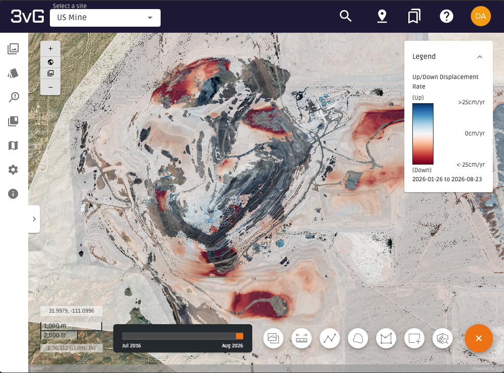
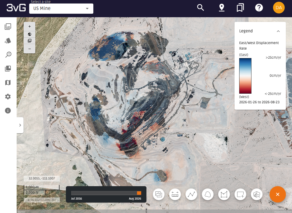
An additional benefit of combining multiple viewing perspectives is the ability to separate displacement into individual movement components.
Where both east-looking and west-looking observations are available, the measurements can be combined to estimate:
- Vertical displacement
- Horizontal east-west displacement.
This provides additional context that is not available from a single LOS measurement alone.
For geotechnical and monitoring teams, understanding whether movement is predominantly vertical, horizontal or a combination of both can support more informed assessment of site behaviour.
The combined east-looking and west-looking solution remains a two-dimensional representation of displacement, but it provides substantially more information than a single LOS measurement. In areas where both viewing geometries are available, combining the measurements can also improve the accuracy and reliability of displacement estimates when compared with interpreting a single LOS result alone.
Expanding to three-dimensional monitoring
Recent developments in satellite constellations are providing access to additional viewing geometries beyond traditional east- and west-looking observations.
One example is Capella Space, whose mid-inclination orbit (MIO) constellation enables imagery acquisition from north-looking and south-looking perspectives. These observations provide an additional independent line-of-sight measurement that complements conventional east-looking and west-looking datasets.
When three independent viewing geometries are available, displacement can be resolved into:
- Vertical movement
- East-west movement
- North-south movement.
This enables true three-dimensional characterisation of ground movement and provides a more complete understanding of deformation processes.
Bringing multiple perspectives together in Motionary
Motionary is designed to simplify the interpretation of multi-perspective InSAR datasets.
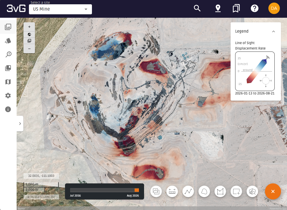
Users can visualise combined displacement products that integrate multiple LOS measurements into a single displacement layer, making it easier to identify areas of movement across a site and quickly understand site-wide deformation patterns.
The platform also retains access to the original east-looking and west-looking LOS datasets, allowing users to compare viewing geometries directly and investigate specific movement patterns in greater detail.
By providing access to both the combined and original LOS results, Motionary supports both rapid identification of areas of concern and deeper technical investigation when required.
A more complete picture of movement
Single-look InSAR remains an effective monitoring solution and, in some regions, may be the only available viewing geometry.
Where multiple perspectives can be acquired, however, combining those observations delivers significant advantages.
Where coverage overlaps, combining measurements from multiple viewing geometries can improve both monitoring completeness and the accuracy of displacement estimates.
Dual-look InSAR can extend site coverage, reduce the impact of geometric limitations, separate vertical and horizontal displacement components and provide a clearer understanding of site-wide movement patterns.
By bringing together measurements from multiple viewing directions, monitoring teams can gain greater visibility into ground behaviour, more effectively identify and assess areas of movement, and make decisions based on a more complete picture of site conditions.
 |  |
 |  |
 |  |