Case Study
Comprehensive approach to risk mitigation in urban excavation project
19 July 2022
When preparing for any major urban construction project, it is often important that engineering calculations are validated long-term using measurable data that enables predictability and mitigates risk. Real-time automated monitoring provides a considerable return on investment, as it means engineers are not likely to overdesign due to a lack of certainty related to soil characterization and load response, and allows stakeholders to capitalize on the long-term value savings, while also providing contractors and engineers with increased on-site safety, planning accuracy, and productivity gains. Finally, it allows operations managers to ensure that infrastructure stability regulations are met, reducing costs and time delays.
Automated instrumentation enables less spending when it comes to engineering, on-site works, and site awareness. The recent Edifício Fidelidade in Portugal proves how true this statement is. One of the few Portuguese urban engineering projects to rely so heavily on automation in geotechnical monitoring, the project takes a novel approach by focusing on an array of instrumentation, data logging, monitoring, and reporting that gives engineers the ability to predict and mitigate risk during the construction phase, as well as continue to monitor and control the impact of the project once it’s operational.
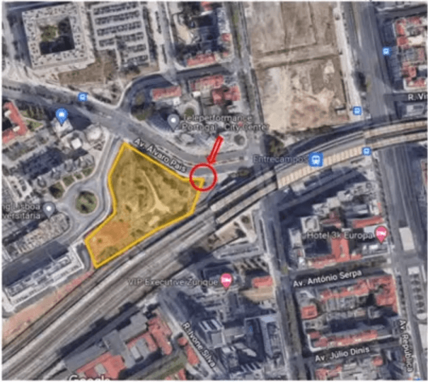
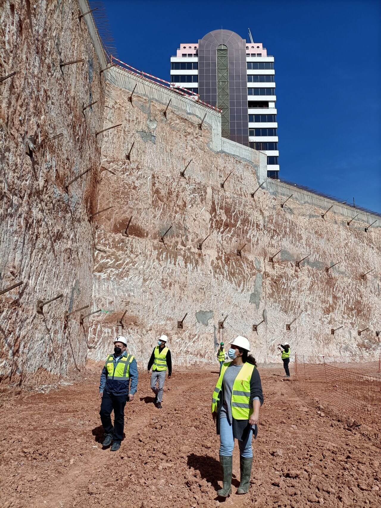
Urban excavation and construction in Lisbon
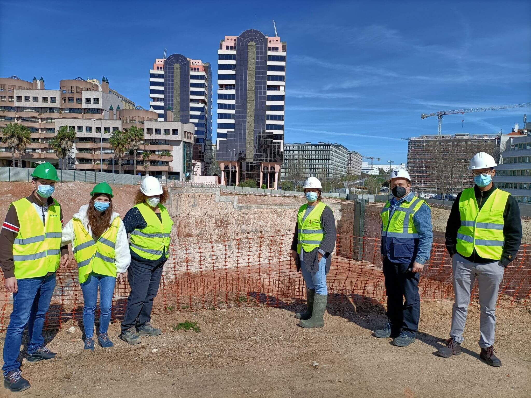
The major office building project is being overseen by several players working in conjunction: Level, a geotechnical data management company and owner of the 24/7 multi-source monitoring platform, the contractor, DST, responsible for the work execution, Jet SJ Geotecnia, the consultant responsible for the geotechnical monitoring plan, and Geoint, the field instrumentation company with previous experience in automated monitoring projects.
With multiple stakeholders working in conjunction and with various moving parts, automated instrumentation was necessary to provide alignment through shared access to displacement, water pressure data analysis, and loads from the load cells—all collected in one place.
When completed, this three-to-five floor commercial building will provide offices for the insurance industry. At over 6000 square metres, optimizing space was a key consideration. With a nearby major railway and other civil infrastructure to consider, automated monitoring would prove a valuable component of the observation and instrumentation plan. This plan included calculating the main site conditions, conducting geotechnical modelling, and allowing for back analysis and design optimization.
Emphasis on remote data collection
It became clear quite quickly to the parties involved that engineering of this scope—and with so many variables—would require continuous sampling and reporting to optimize the project, validating soil response predictions, identifying over- or under-engineered sections, and ensure that deformation is being reported below the anticipated deflection thresholds.
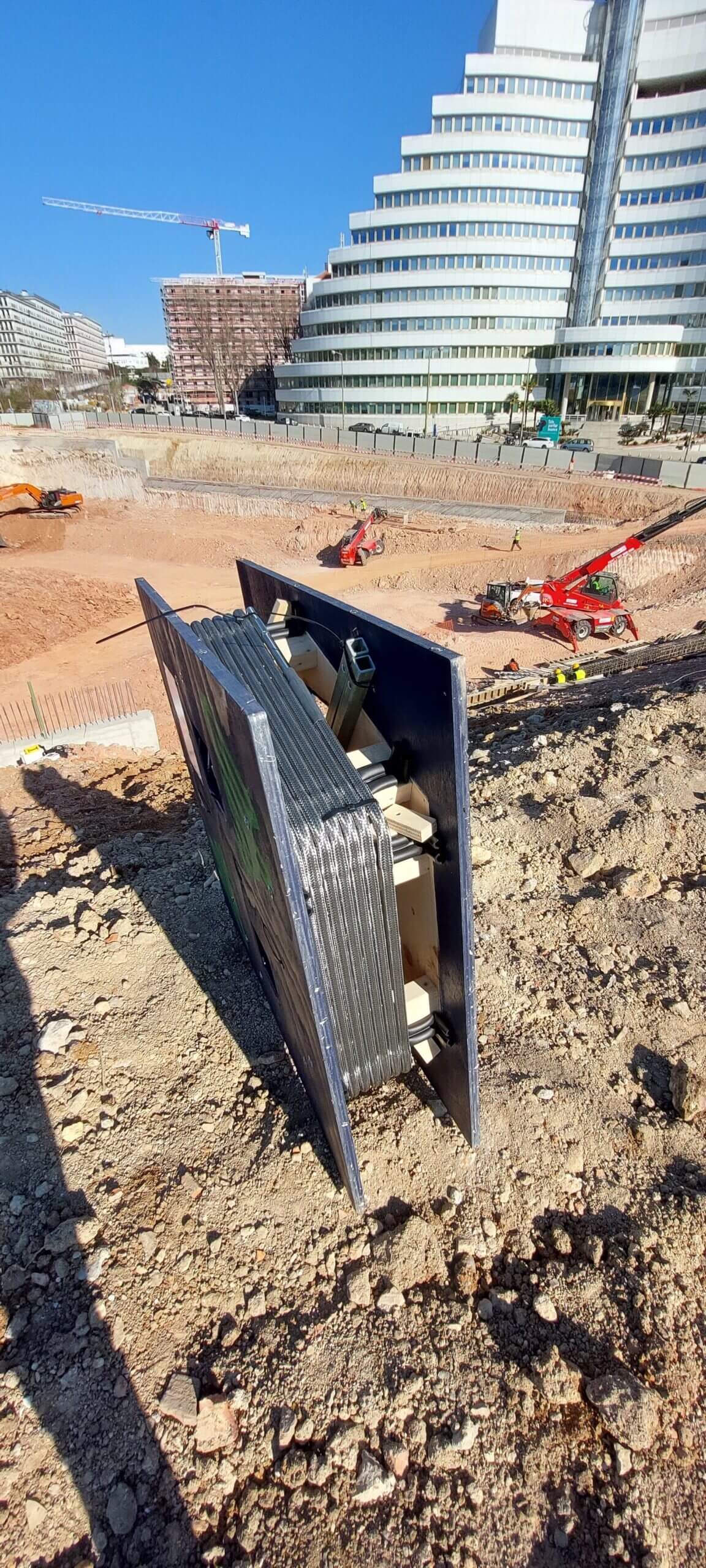
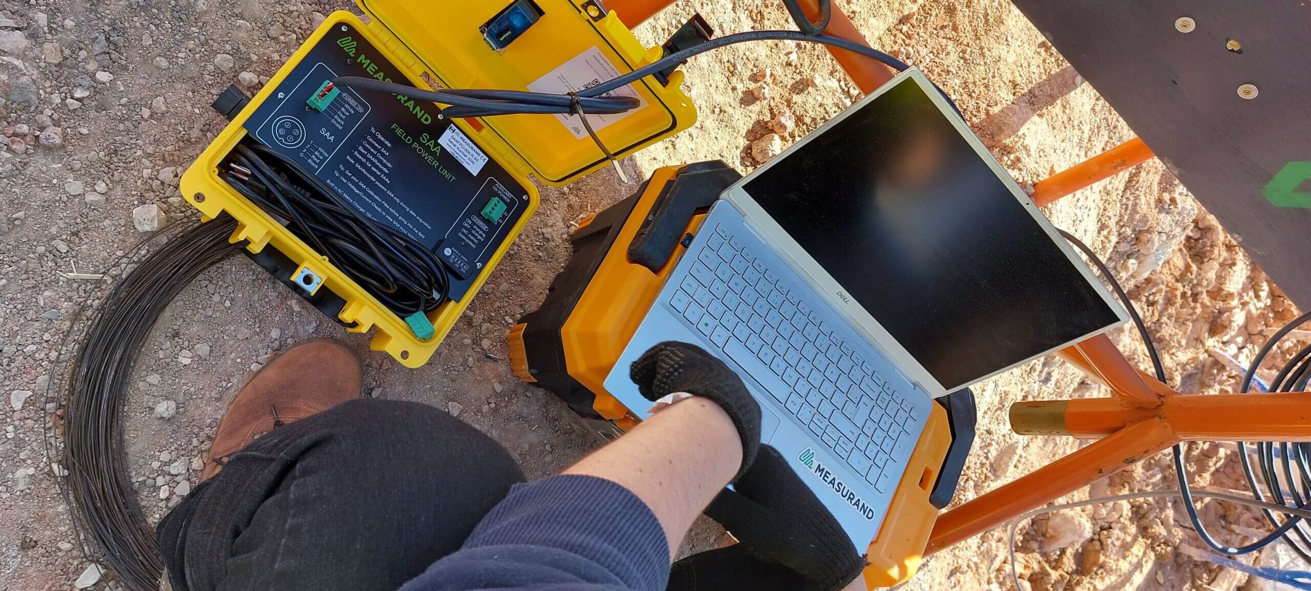
Through a combination of ShapeArrays, piezometers, tiltmeters, and load cells reporting remotely collected data via FTP, the stakeholders could control costs and guarantee more efficient scheduling. This type of foresight also allows engineers the ability to assess and mitigate risk during the construction phase, as well as continue to monitor and control the impact of the site once it’s operational.
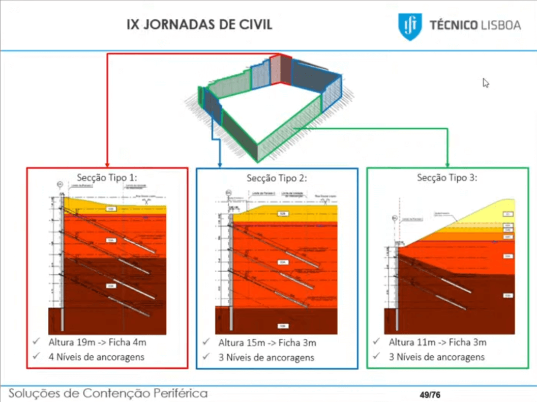
This project approached automated monitoring instrumentation on a scale not typically used in an urban engineering project of this size in Portugal, which is typically a cost-driven market when it comes to investment in monitoring solutions. The instrumentation includes:
- 30 tiltmeters
- Four ShapeArray in individual inclinometer casings to measure deflection in the diaphragm walls
- Two piezometers for underground water level monitoring and phreatic lowering
- Twelve load cells on diaphragm wall to measure anchor loads
Furthermore, thanks to Loadsensing Edge wireless data loggers reporting site data via FTP every six hours, stakeholders are able to access data immediately and remotely via Level data management platform, Level Sensing, allowing them to conduct visual site assessments as necessary and conduct maintenance as soon as it’s needed.
All the geotechnical instrumentation and sensors can be retrieved and reused in future projects, which was attractive to the project’s partners.
Comprehensive risk mitigation
This type of foresight allows engineers the ability to measure movement and observe geotechnical variables at all phases, monitoring and controlling the impact of the project throughout its lifespan. These instruments, working together with a thorough preliminary geological site assessment, can create the data sets necessary to predict and ultimately avoid risk, while also validating the engineering predictions, and strengthening future projects of this type.
Automated instrumentation also allows for better control of aspects of a project across multiple departments and stakeholders. This type of data-rich approach leads to a better understanding of the field conditions and more efficient reporting—and more information means more peace of mind.
From conception to execution, automated instrumentation and data logging helps engineers and project stakeholders:
- Take measures to optimize the project
- Assess the behaviour of the retention walls
- Use the observational method to determine if the design can be optimized to save costs related to project scheduling or materials
- Determine the alert and alarm thresholds to mitigate risk
- Analyze the data for future projects
The success of this project proves that investment in automated instrumentation and data logging pays considerable dividends, increasing productivity, maximizing efficiency, safeguarding local infrastructure and human life, and retaining legal compliance.
Speak with an expert to learn how ShapeArray can be used in your urban excavation project today