Blog
Introducing MonitorIQ® Next
22 Apr 2026
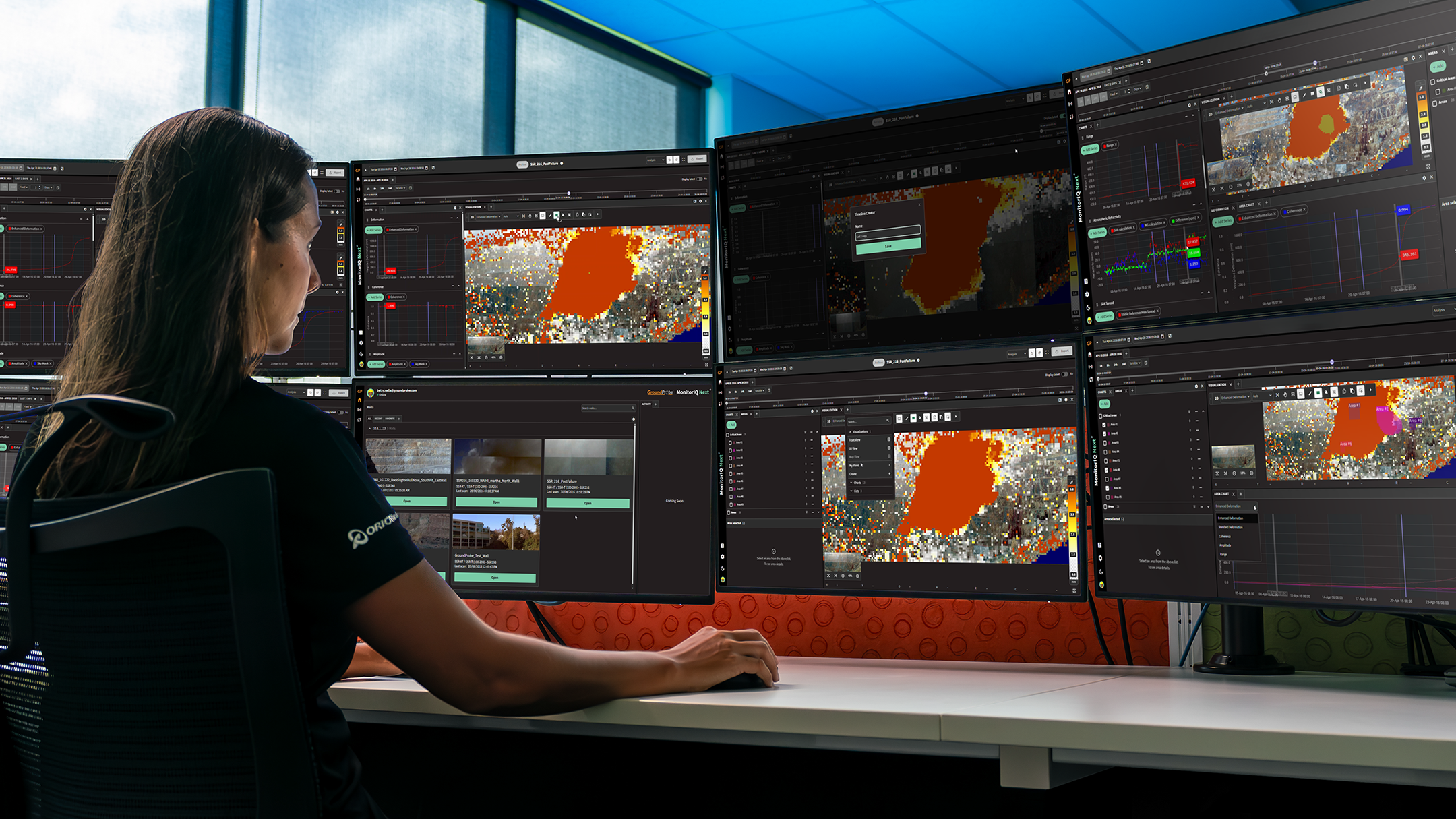
Sophisticated technology should simplify work, not slow it down. With MonitorIQ® Next, we’ve reimagined geotechnical analysis software to combine advanced capability with clarity, usability, and clean, accurate data.
MonitorIQ® Next is our next-generation software platform featuring a brand-new user interface, powerful new tools, and flexible web browser access. Designed for both technical and non-technical users, it delivers high-performance monitoring data analysis without unnecessary complexity.
The result is a platform that clearly proves one thing: advanced doesn’t have to mean complicated.
A Next-Generation Platform, Built Around the User
MonitorIQ® Next introduces a completely refreshed look and feel, paired with intuitive workflows that make everyday tasks faster and easier. The modern UI is clean, logical, and highly responsive, helping users focus immediately on the information that matters most.
Behind the interface is a suite of superior new features designed to support more confident analysis, better collaboration, and more accurate decision-making, without adding learning curves or operational friction.
A Fully Customisable User Interface
Every monitoring environment is different, and MonitorIQ® Next adapts to the way users work. The customisable user interface allows layouts, charts, and timelines to be tailored to individual preferences or operational roles.
By ensuring that each user sees the most relevant data every time they log in, teams can streamline workflows, reduce screen clutter, and move more quickly from observation to analysis to action.
Browser-Based Access, Anywhere You Need It
With web-based browser access, MonitorIQ® Next removes barriers to visibility and collaboration. Users can view and manage radar data from any supported browser, on-site or remotely, without installing software.
A simplified login process makes access smoother and more secure, enabling teams to connect quickly, share insights, and maintain situational awareness from wherever they are.
New Areas of Concern for Better Analysis and Collaboration
MonitorIQ® Next introduces Areas of Concern, a powerful new way to focus analysis and improve team coordination.
Users can create, save, and view key areas directly from the analysis screen, customise groups, and configure alarms with ease. This makes it simpler to collaborate, maintain consistency across teams, and ensure everyone is working from the same understanding of risk and priority zones.
More Seamless, High-Definition Visual Context
Confident decisions depend on clear visual alignment between data and the real world. MonitorIQ® Next enhances this with high-definition panoramic images, captured using a new HD camera and an advanced mosaicking algorithm.
Radar data is precisely aligned to real world visuals, creating a seamless, accurate view that improves interpretation and strengthens confidence in analysis outcomes.
Clearer Spatial Insight with Enhanced 3D Visualisation
Monitoring complex environments demands spatial clarity. The enhanced 3D wall visualisation in MonitorIQ® Next delivers faster performance, improved alignment, and easier interpretation.
With georeferenced data overlays, new user controls, and support for imported GeoTIFFs, both technical and non technical users can quickly understand spatial relationships, assess risk accurately, and make informed decisions, helping to avoid unnecessary pit evacuations.
…………………..
2D RADARS ONLY – SSR-FX & SSR-OMNI
Greater Confidence with Precision Atmospherics
For 2D radar users, MonitorIQ® Next includes Precision Atmospherics, our patented advanced atmospheric correction algorithm that reduces false alarms and improves data integrity.
Combined with the high-speed scanning capabilities of the SSR FX and SSR Omni, the system manages rapid atmospheric changes while delivering data faster and accurately tracking fast moving walls.
New Front-View Visualisation for Natural Interpretation
Understanding slope movement is now more intuitive with front-view visualisation, available for 2D radars.
Radar data is aligned with both the radar photo and the digital terrain model, allowing users to view movement from a first-person perspective. This natural view simplifies interpretation, enhances situational awareness, and supports clearer decision-making.
…………………..
Sophisticated Technology, Simplified
MonitorIQ® Next brings together advanced analytics, high-definition visualisation, and flexible access, all within a clean, intuitive software experience. By removing unnecessary complexity, it empowers users to work confidently with accurate data and powerful tools.
Advanced doesn’t have to mean complicated. MonitorIQ® Next proves it.
For further reading, visit: MonitorIQ® Next
Related products and services

Business
Digital Solutions

Digital Solutions
Geosolutions

Digital Solutions
GroundProbe

Digital Solutions
MonitorIQ® Next

Digital Solutions
Slope Stability Radars

Digital Solutions
GroundProbe SSR-XT Slope Stability Radar
