
Case Study
Citywide Subsidence Monitoring with Millimeter Precision
17 Aug 2022
Project Overview
3vG conducted an analysis on a replacement tunnel project in Seattle, WA. The City of Seattle began digging a 1.7 mile long, 57-foot diameter tunnel underneath its downtown core in July 2013 as part of a $2.1B civil engineering and infrastructure project to replace the Alaskan Way Viaduct. The world’s largest-diameter tunnel boring machine, nicknamed “Big Bertha”, stopped operating in December 2013 underneath Seattle’s historic Pioneer Square area.
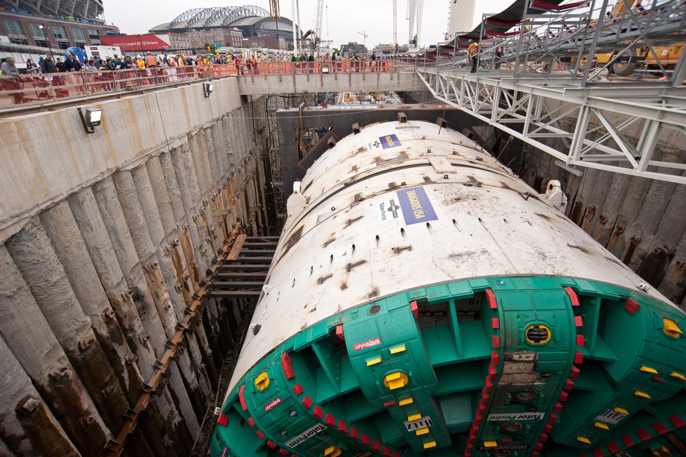
The world’s largest-diameter tunnel boring machine, nicknamed “Big Bertha”.
In November 2014, crews began digging a 120-foot deep vertical recovery pit to access and repair Big Bertha. A large amount of groundwater pumping took place from November 2014 to December 2015, leading to significant ground settlement, cracking, and other visible damage to neighbouring buildings. A large sinkhole also formed approximately 35 feet from the recovery pit in January 2016, leading the Governor of the state to temporarily shut down the project.
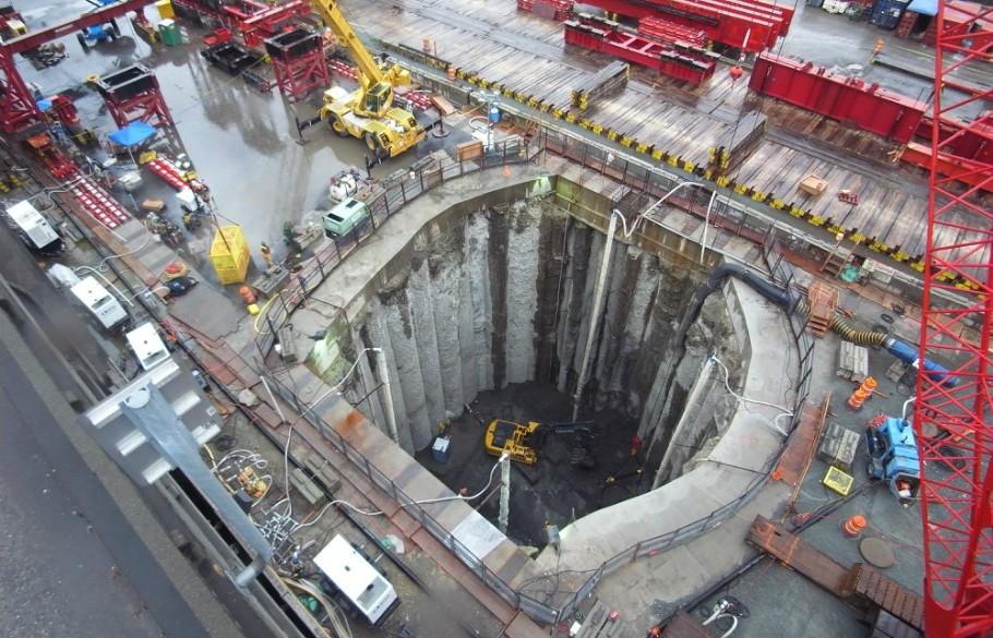
WSDOT webcam of Bertha's repair pit, Dec. 10, 2014
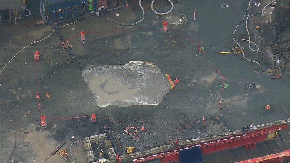
A large sinkhole that formed approximately 35 feet from the recovery pit in January 2016.
Challenges
- Extensive tunneling through the downtown area
- Widespread subsidence of up to 60 mm, radiating outward more than 1 km away from the project
- Traditional surveying methods could not detect the displacement, due to its size resulting in misleading measurements
Solution/Results
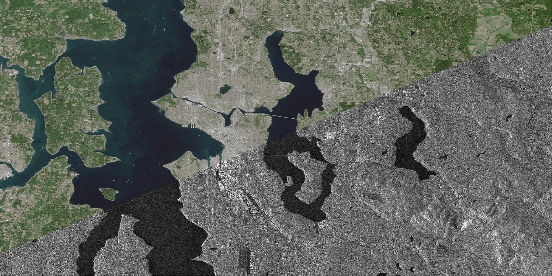
3vG analyzed RADARSAT-2 images collected for a 20 km x 20 km area between February 2013 and August 2015 to measure ground displacement over time. The InSAR results show that the ground was relatively stable from February to December 2013, prior to Big Bertha becoming operational. From December 2013 to October 2014, the ground was displaced 10 – 20 mm along the route of Big Bertha. In November 2014, the ground suddenly began sinking significantly, with up to 60 mm of total displacement occurring over the next nine months.
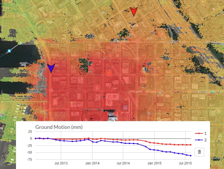
InSAR results analyzed from RADARSAT-2 images collected for a 20 km x 20 km area between February 2013 and August 2015.
Benefits
- Broad geographic footprint allows detection of subsidence up to half a mile away
- Satellite monitoring utilizes a stable reference point; traditional surveying involves measuring displacement of a specific location relative to an assumed stable location
- Detects millimetre-scale displacement every 11 days
- Actionable intelligence on initial signs of movement to prevent or minimize significant visible damage.
Conclusion
3vG can access SAR images for all major cities globally. Our clients are proactively using InSAR data to be informed on how their engineering construction projects are impacting the topography in and around the project sites. 3vG recommends incorporating InSAR monitoring services to any project involving tunneling, ground excavation, and large amounts of groundwater pumping.
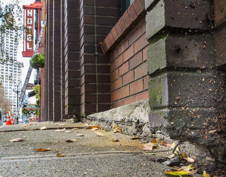
Ground settlement, cracking, and other visible damage to neighboring buildings took place due to a large amount of groundwater pumping.