
Case Study
Harnessing the Power of InSAR and Ground-Based Radar for Comprehensive Geotechnical Monitoring
10 Dec 2024
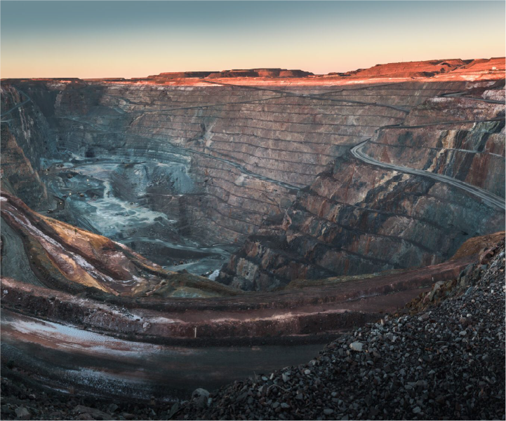
In the recent webinar, Combining Ground-Based Radar and InSAR for Monitoring Displacement, our experts from 3vGeomatics and GroundProbe discussed the use of Interferometric Synthetic Aperture Radar (InSAR) and ground-based radar technologies in several monitoring situations, particularly in mining operations. The discussion included a detailed overview of both technologies, their applications, benefits, and recent advances, highlighting the importance of integrating data from both sources for comprehensive monitoring and risk management.
Speakers
- Jon Leighton, Director of Operations at 3VGeomatics
- Antonio Rocha, Head of Global Business Development at GroundProbe
The webinar covered
- Detailed overview of ground-based radar technology by Antonio Rocha
- Detailed overview of InSAR technology by Jon Leighton
- Recent advances in both technologies
- Discussion on the integration of both technologies for comprehensive monitoring
- A question-and-answer session
Takeaways from Combining Ground-Based Radar and InSAR for Monitoring Displacement
Takeaway 1: Incorporating Both InSAR and Ground-Based Radars for Comprehensive Geotechnical Monitoring
The integration of InSAR and ground-based radars was discussed as a comprehensive approach to geotechnical monitoring in mining operations. Jon Leighton of 3vGeomatics explained that InSAR provides a big picture, looking over long periods and informing subsequent monitoring decisions. Antonio Rocha from Ground Probe emphasized the role of ground-based radars for focused, real-time monitoring and alarm-based decisions. Both experts agreed that combining these technologies allows for extensive area coverage, detailed analysis using multiple data sources, and early detection of geological changes. They also mentioned that their respective support services can provide 24/7 monitoring, validate false alarms, and produce reports.
Takeaway 2: Challenges and Advances in InSAR and Ground-Based Radar Technology
The webinar also explored the challenges and recent advances in both InSAR and ground-based radar technology. Common challenges include dense vegetation, atmospheric changes, and accuracy related to line of sight. Recent technological advancements are addressing these issues. Jon Leighton mentioned how non-persistent scatter technology in InSAR can double the coverage at mining sites by including targets that were either intermittent or permanently disrupted. He also discussed the development of detection algorithms that distill massive amounts of data into a smaller solution space by focusing on the signal-to-noise ratio rather than simple magnitude. Antonio Rocha discussed Precision Atmospherics, an algorithm developed to reduce the noise caused by atmospheric changes in ground-based radar data.
Takeaway 3: Application of InSAR and Ground-Based Radars in Diverse Environments
The discussion covered the diverse applications of InSAR and ground-based radars in various environments, from open-pit and underground mines to tailing dams and civil infrastructure. These technologies offer the ability to measure almost every aspect of ground movement, aiding in predictive monitoring and emergency management. Antonio Rocha shared that radars can monitor in severe weather conditions, especially in very cold environments. Jon Leighton added that InSAR is a great technology for monitoring vertical displacement, especially in urban environments and over linear infrastructure. Both experts emphasized that trends in movement are more important than magnitude when monitoring geotechnical structures.
Key Insights: Both InSAR and ground-based radar technologies are crucial for monitoring to make risk-informed decisions, particularly in mining operations.
- InSAR provides a big picture and helps in planning the next monitoring phase, while ground-based radar is key for focused monitoring and real-time, alarm-based decisions.
- Trends are more important than magnitude in monitoring geotechnical structures.
- Geotechnical Support Services can monitor data 24/7, validating false alarms and producing reports.
- Integrating all geotechnical sensors into a data aggregation platform like GeoExplorer can provide significant benefits.
The webinar underscored the importance of leveraging both InSAR and ground-based radar technologies for comprehensive and effective geotechnical monitoring, ensuring the safety and efficiency of mining operations and other critical infrastructure.
Watch the webinar on-demand to learn more about how to combine ground-based radar and InSAR for monitoring displacement.