
DIGITAL SOLUTIONS
Affinity+
Reliable wireless data logging for connected geotechnical monitoring.
About Affinity+

About Affinity+
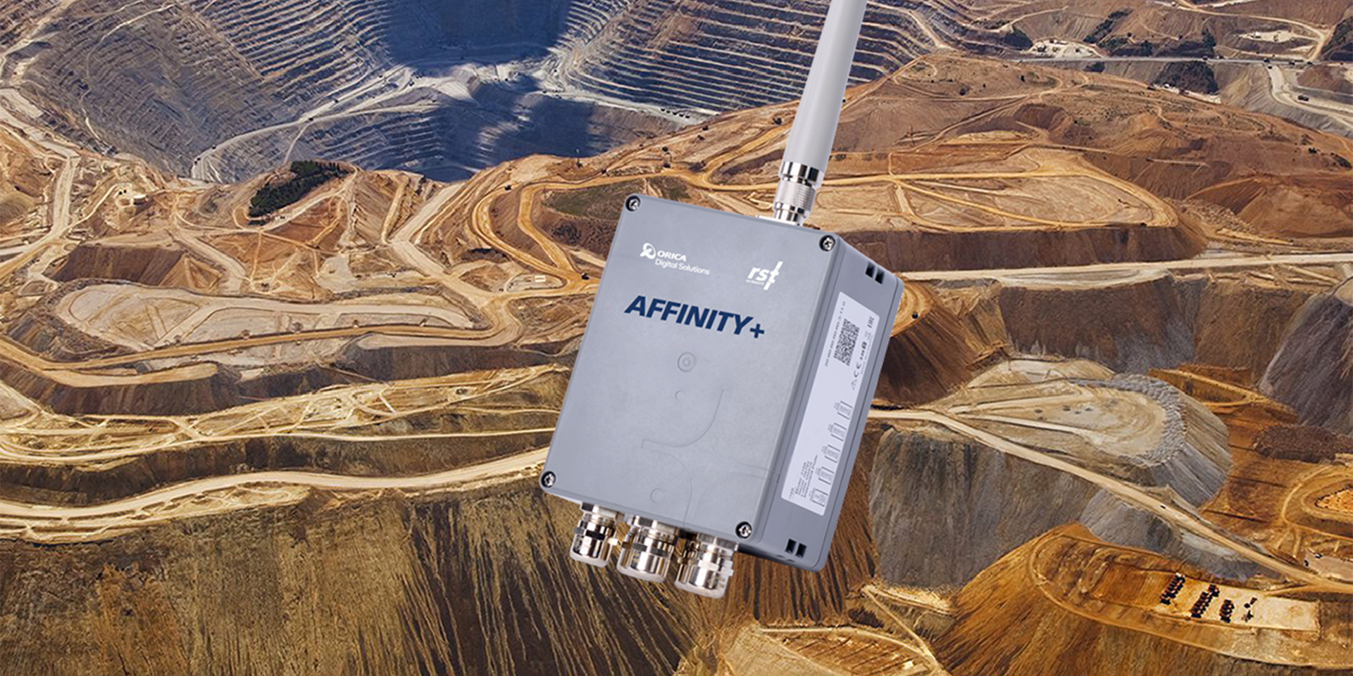
Affinity+ by RST Instruments delivers reliable, automated data collection for geotechnical and structural monitoring across mining and civil infrastructure applications.
By combining flexible wireless data logging, LoRaWAN communication, and integrated monitoring software, Affinity+ simplifies data collection, reduces operating costs, and delivers trusted insights to support informed decision-making.
The Affinity+ range is comprised of the Affinity+ Data Logger, Affinity+ Tilt Logger, Affinity+ Single Channel Vibrating Wire Data Logger, and the Affinity+ Gateway.
Simplify geotechnical monitoring with Affinity+
Designed for civil and geotechnical engineers, Affinity+ combines flexible wireless data logging, LoRaWAN communication and integrated monitoring software to provide a reliable and efficient approach to collecting and managing critical site data.
As part of the Orica Digital Solutions Geosolutions ecosystem, Affinity+ connects field instrumentation with GEOExplorerIQ™, bringing fleet management, monitoring data, visualisation, analysis, reporting and event management together in one integrated solution.
From sensor to insight, Affinity+ helps engineers understand changing ground and structural conditions, manage risk and protect critical assets.
Benefits
Benefits

Data insights

Ease of use

Improve safety
Why choose Affinity+
Why choose Affinity+
Wireless monitoring for mining and civil infrastructure
Wireless monitoring for mining and civil infrastructure
GEOExplorerIQ™ integrated
Affinity+ forms part of Orica Digital Solutions' integrated sensor-to-software monitoring ecosystem.
Through integration with GEOExplorerIQ™, engineers can bring monitoring data into a centralised environment for visualisation, analysis and informed decision-making.
Explore the Affinity+ product range

Digital Solutions
Affinity+ Data Logger

Digital Solutions
Affinity+ Gateway

Digital Solutions
Affinity+ Tilt Logger

Digital Solutions
Affinity+ Vibrating Wire Data Logger

Digital Solutions
GEOExplorerIQ™
Industries
Industries

Civil infrastructure

Energy

Surface metal
Underground mining
RST Instruments range

Digital Solutions
Affinity+

Digital Solutions
Crack Meters

Digital Solutions
Data Loggers

Digital Solutions
Extensometers
Digital Solutions
GEOExplorerIQ™

Digital Solutions
Inclinometers

Digital Solutions
Pressure Cells

Digital Solutions
Piezometers

Digital Solutions
Load Cells

Digital Solutions
Readouts

Digital Solutions
Settlement Systems

Digital Solutions
Signal Cables

Digital Solutions
Strain Gauges and Strain Meters

Digital Solutions
Tiltmeters

Digital Solutions
Thermistors

Digital Solutions
Service and Partners

Digital Solutions
Software
Our RST Instruments Industry Solutions
Our RST Instruments Industry Solutions


Explore more
We are a global leader in geotechnical, geospatial and structural monitoring. We deliver a complete portfolio, from sensors to services, for mining and civil infrastructure customers. Our expertise is grounded in Orica's innovation and technical excellence that span more than 150 years.


Contact an expert
Contact an expert