
DIGITAL SOLUTIONS
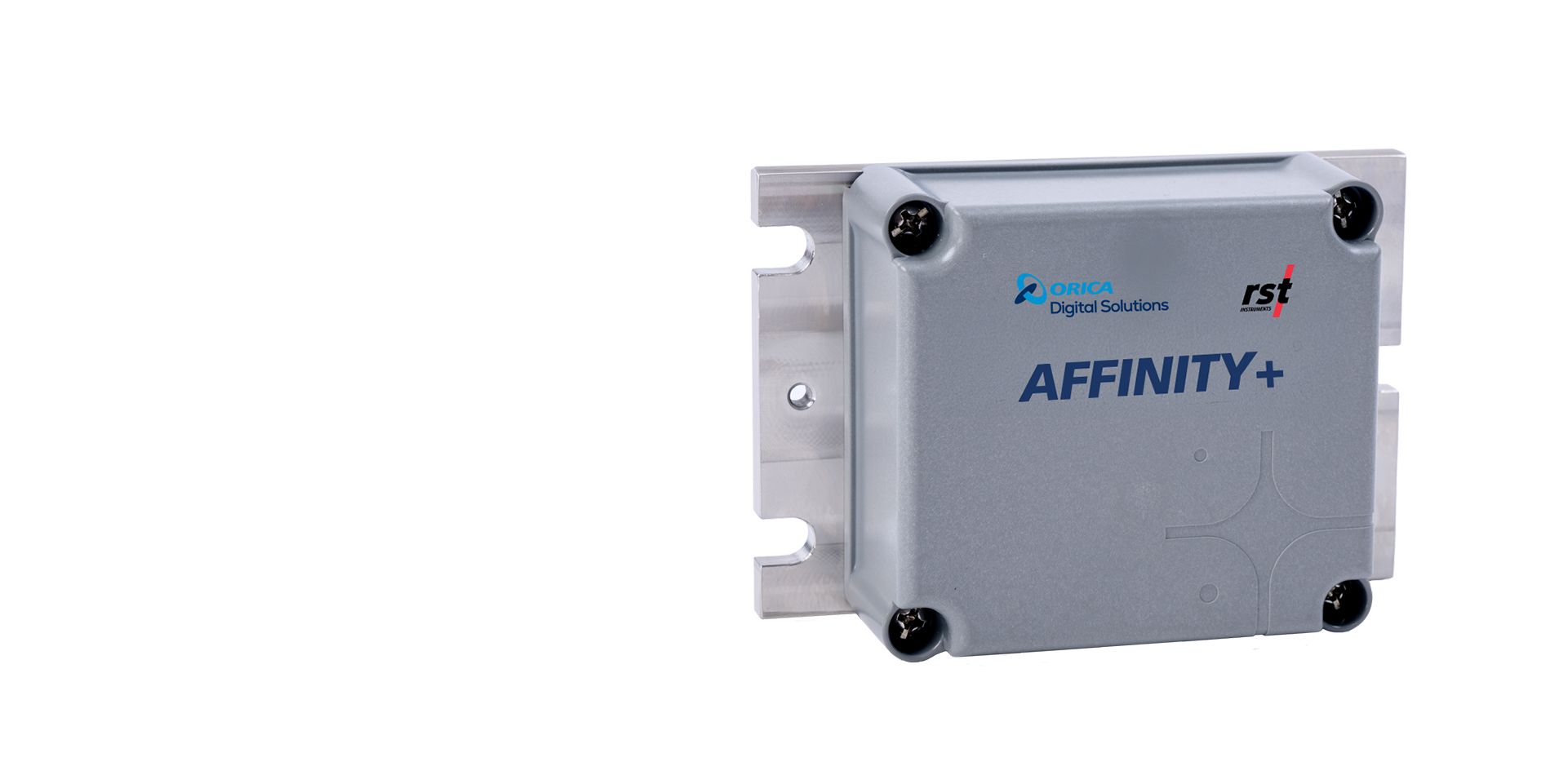
Affinity+ Tilt Logger
Monitor structural movement with automated tilt measurements.
Overview

Overview
The Affinity+ Tilt Logger provides automated monitoring of structural movement by measuring tilts in three axes. Designed for infrastructure, rail, excavation, and geotechnical monitoring applications, it helps identify changes in structural orientation that may indicate movement, deformation, or developing instability. By continuously measuring tilt relative to an established baseline, the logger provides early visibility into changing site conditions while eliminating many limitations of manual monitoring.
As part of the Affinity+ monitoring ecosystem, the Affinity+ Tilt Logger combines wireless data collection, Bluetooth® configuration, and seamless integration with GEOExplorerIQ™ software to deliver a continuous flow of field measurement data from various sensors to reporting.
Smarter alternative to manual monitoring
Many infrastructure and excavation projects still rely on manual prism monitoring systems to track structural movement. While effective, these approaches require regular site visits, increasing labor costs and adding delays between data collection and decision-making.
The Affinity+ Tilt Logger automates this process by providing uninterrupted monitoring and near real-time visibility into changing conditions. Whether installed on retaining walls, excavation support systems, buildings, rail infrastructure, or other critical structures, it reliably indicates movement without frequent on-site data collection.
As part of a connected Affinity+ monitoring network, it enables engineers and project teams to view and manage measurement data within one integrated monitoring environment rather than navigating multiple vendors and disconnected applications.
How the Affinity+ Tilt Logger Works
How the Affinity+ Tilt Logger Works
Key Features
Key Features
Resources
Resources
GEOExplorerIQ™ integrated
The Affinity+ Tilt Logger is more than a standalone monitoring device. As part of the Affinity+ ecosystem, it helps connect field measurements with the software tools used to visualise data, manage hardware, and assess structural behaviour. When deployed alongside Affinity+ Gateways and GEOExplorerIQ™, the logger supports a connected monitoring workflow that gives users access to measurement data through a unified platform. This reduces the need for multiple software systems and vendors while providing a more streamlined approach to infrastructure and geotechnical monitoring.
Built for infrastructure and geotechnical monitoring
Built for infrastructure and geotechnical monitoring
Affinity+ Tilt Logger Specifications
| Specification | Details |
|---|---|
| Primary Function | Automated three-axis tilt monitoring |
| Measurement Type | Tilt and angular movement |
| Configuration | Bluetooth® via Affinity mobile application |
| Data Access | Bluetooth CSV download or Affinity+ system integration |
| Communication | Wireless communication with Affinity+ Gateway |
| Software Integration | GEOExplorerIQ™ |
| Environmental Protection | IP68-rated enclosure |
| Power Supply | Customer-serviceable batteries |
| Optional Variant | High-vibration sensor model for rail monitoring |
| Applications | Infrastructure, rail, excavation, and geotechnical monitoring |
Affinity+ Tilt Logger Frequently Asked Questions
Affinity+ Tilt Logger Frequently Asked Questions
The Affinity+ product range

Digital Solutions
Affinity+ Gateway

Digital Solutions
Affinity+ Data Logger

Digital Solutions
Affinity+ Tilt Logger

Digital Solutions
Affinity+ Vibrating Wire Data Logger

Digital Solutions
GEOExplorerIQ™
RST Instruments range

Digital Solutions
RSTAR Affinity

Digital Solutions
Affinity+

Digital Solutions
Data Loggers

Digital Solutions
Software

Digital Solutions
Piezometers

Digital Solutions
Inclinometers

Digital Solutions
Tiltmeters

Digital Solutions
Settlement Systems

Digital Solutions
Extensometers

Digital Solutions
Crack Meters

Digital Solutions
Strain Gauges and Strain Meters

Digital Solutions
Pressure Cells

Digital Solutions
Load Cells

Digital Solutions
Thermistors

Digital Solutions
Signal Cables

Digital Solutions
Readouts

Digital Solutions
Service and Partners
Explore more
We are a global leader in geotechnical, geospatial and structural monitoring. We deliver a complete portfolio, from sensors to services, for mining and civil infrastructure customers. Our expertise is grounded in Orica's innovation and technical excellence that span more than 150 years.


Contact an expert
Contact an expert